.png)
 4 weeks ago
38
4 weeks ago
38
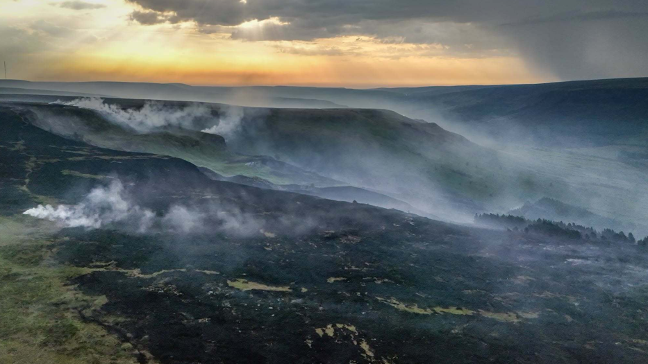 Image source, Derbyshire Fire and Rescue Service/Anadolu via Getty Images
A wildfire in Glossop, Derbyshire, on 25 June as an intense early-summer heat wave gripped the UK, bringing unusually high temperatures and leaving vegetation dry and highly flammable
Parts of the UK are facing an "exceptional" risk for wildfires over the next few days as a record-breaking heatwave continues.
On Sunday, a large part of southern England and pockets of the south Midlands are assessed to be at "exceptional" risk, according to Natural England, external.
Many other areas in England and Wales are at "very high" risk, which will continue throughout this week.
It comes as parts of the UK are set to enter their second week of temperatures above the heatwave threshold.
As a result, amber and yellow heat health alerts have been issued by the UK Health Security Agency (UKHSA) from 09:00 BST on 12 July to 21:00 on 15 July.
That means significant impacts are likely across health and social care services due to the high temperatures, including a rise in deaths, particularly among those with health conditions or aged 65 and older.
Heatwave to persist for second week
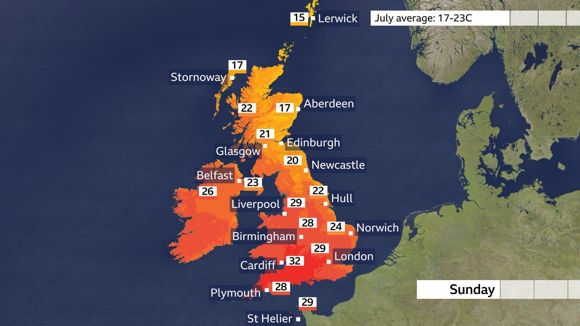
While heatwave conditions will continue across many parts of England and Wales through this coming week, a brisker wind means temperatures have dropped a degree or two relative to recent days.
Areas that have experienced the biggest drop in temperature are those close to North Sea coasts, with highs on Sunday and Monday forecast to be around 18-21C (64-70F).
Even with the breeze, it will remain hot across the western half of England and Wales with highs of 26-30C widely, and 31-33C possible in parts of south-east Wales and south-west England through Sunday.
Amber health alerts issued by the UKHSA run until Wednesday evening for south-west England and the West Midlands, to coincide with where the highest temperatures are expected.
Heatwave conditions are expected to remain more widely in the north-west of England, East Midlands, east of England, London and the south-east, where a yellow alert is in effect for the same period.
From Monday, England and Wales will see temperatures continuing to reach around 30-32C but it is unlikely they will rival last week's readings in the mid-30s.
Parts of Scotland and Northern Ireland could potentially see heatwave conditions returning by midweek.
Why is the fire risk so high and how long will it last?
Three record-breaking heatwaves and a prolonged lack of rainfall have left many parts of England and Wales facing an increasing wildfire risk.
Over the next few days, the continued hot and dry weather, coupled with strengthening winds and lower humidity, is expected to accelerate the drying of vegetation, increasing the risk for fires.
Stronger winds would also allow any fires that do break out to spread more rapidly and become harder to contain.
The risk is expected to ease slightly towards the middle of next week as winds become lighter and the chance of showers increases. However, current forecasts suggest "exceptional" wildfire danger could persist across East Anglia by Wednesday.
A National Fire Chiefs Council spokesperson said: "When the weather stays hot and dry, it only takes one spark to start a wildfire. What can begin as a small fire can spread incredibly quickly, putting people, homes, wildlife and our countryside at risk."
When will the heatwave finally break?
With lower pressure sitting in the Bay of Biscay, the far south-west of England could start to see some showers from Sunday, but more particularly on Monday.
This same low pressure will nudge further north over the week ahead, so the chance of thundery showers will also extend north, affecting southern England and southern Wales on Tuesday, then the Midlands into Wednesday.
These thunderstorms are forecast to become more widespread by Thursday, but even with the shower chance, the temperatures will remain in the high 20s and low 30s.
It is not until the end of the week that the heat eases. By then, the chance of rain is greater more widely across the UK as the associated low pressure drifts northwards.
This will introduce a cooler north wind, heralding an end to heatwave conditions.