.png)
 1 month ago
23
1 month ago
23
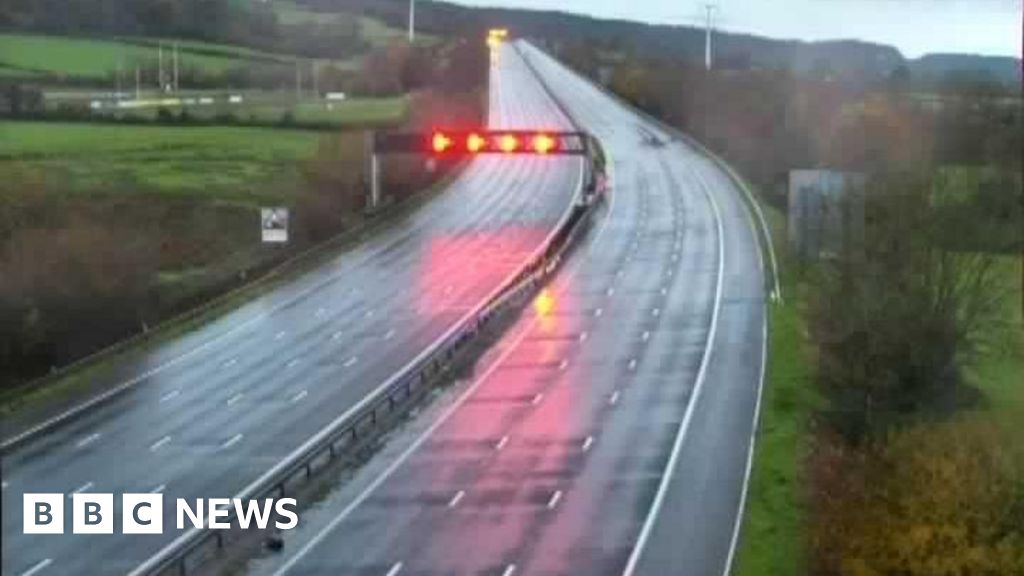
Storm Benjamin has been named by Météo France and will bring wet and windy weather to the United Kingdom on Thursday.
However, the most severe impacts will be felt across France, Belgium and the Netherlands.
In the UK heavy rain could lead to localised flooding and strong winds have the potential to bring travel disruption and minor damage.
The Met Office has issued yellow severe weather warnings for both the wind and rain.
Heavy rain will spread north-east across England and east Wales into Thursday.
The Met Office yellow warning for rain covers much of southern and eastern England from midnight on Wednesday night into Thursday, and through until 21:00 BST.
Rainfall totals by early Thursday morning could be widely 20-30mm (around 1in), and for some places 30-50mm (up to 2in).
There is a small chance a few places could exceed this, most likely over Devon, Cornwall up to the East Midlands, Lincolnshire, Humberside and East Anglia.
Localised flooding and some transport disruption is possible.
The wind will also strengthen for a time in the early hours across Kent and Sussex, with a Met Office yellow warning in force across eastern England from 03:00 Thursday until 23:59 BST.
While conditions could improve temporarily, the winds will pick up again during the afternoon.
There is an additional yellow warning from covering west Wales and south-west England from 06:00 until 15:00 BST.
Very strong north-westerly winds gusting to 45-55mph (70-90km/h) in both areas are possible, while locally 60mph (97km/h) on exposed coastal areas.
While there is still some uncertainty on the intensity of this weather system, the Met Office warns that there is potential for gusts up to 75mph (120km/h) for a small period of time later on Thursday morning down the North Sea coast.
These wind speeds have the potential to topple trees or their branches, cause travel disruption and even bring power cuts.
For many in the UK Storm Benjamin will probably end up bringing nothing more than a typical autumnal wet and windy day.
Impacts are not forecast to be severe enough for the Met Office to name this weather system.
However, large parts of northern and western France will experience strong winds with gusts widely up to 50-65mph (80-105km/h) and 80mph (130km/h) on some coastal areas.
Because this is likely to bring impacts with some damage and travel disruption, Météo France - the equivalent of the Met Office in France - took the decision to name this Storm Benjamin.
Orange warnings - the next stage up from a yellow - have been issued for seven areas along the Atlantic coast and English Channel.
Strong winds will also bring the possibility of some damage and disruption to Belgium and the Netherlands later on Thursday with gusts of wind up to 80mph (129km/h), especially near the coast.
Once a meteorological agency takes the decision to name a storm, there is agreement that all nations use the same name to allow consistency and clearer communication of the impacts.
So, while impacts in the UK will be relatively minor with yellow warnings, the wet and windy weather is still associated with Storm Benjamin.
Benjamin will not replace Bram in the list of UK's named storms. So we can still expect the next weather event deemed serious enough to be named by either the Met office, Met Eirean in Ireland or KNMI in the Netherlands to be Bram.